Take the Survey
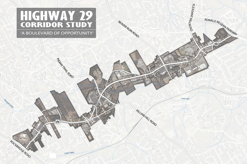
The Hwy 29 Boulevard of Opportunity Study, initiated by the Lilburn Community Improvement District (CID), will address the 4.0 mile section of Highway 29 (Lawrenceville Highway), located within the Lilburn Community Improvement District, between Ronald Reagan Parkway and Rockbridge Road in the central portion of Gwinnett County, Georgia (as illustrated on the following map).
The purpose of the study is to analyze three factors - Transportation, Land Use and Urban Design - in collaboration with market and economic analysis, to create a set of planning recommendations that will redefine this portion of the Highway 29 corridor into a future 'Boulevard of Opportunity.'
Community Survey Results
The Community Survey was distributed at Community Meeting #1 on September 23, 2010. The survey was also available online from Setember 23rd to October 27th. A total of 293 responses were received and results were reviewed at Community Meeting #2 on October 28, 2010.
Hwy 29 Boulevard of Opportunity Community Survey Results